-40%
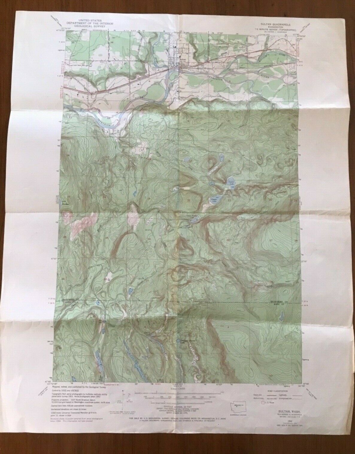
1953 Map Sultan Washington State US Interior Geological Survey Topographic USGS
$ 7.91
- Description
- Size Guide
Description
A vintage 1953 map of Sultan, WA. This is a US Department of the Interior Geological Survey map. It is a topographic map with contour intervals of 20 feet. This map is in the central part of Washington State. There is a county line between Snohomish and King counties. Some of the landmarks are Skykomish River, Cedar Ponds Lake, Dagger Lake, Tomtit Lake, the town of Sultan, Drunken Charlie Lake, and the Great Northern US Route road. This map has folds , and a very small hole on a fold line in the top middle map fold. It is in overall intact and great condition for being from 1953. It measures 26 3/4" x 21 3/8". Thanks for looking, and please ask any questions you may have about this amazing map!I was born and raised in Washington State and know a lot about it. I have been an ebay member since 2002 and have an track record of excellent customer service. Check out my other items!
