-40%
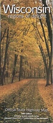
Official Wisconsin State Highway Map, Regions of Delight 1999
$ 2.08
- Description
- Size Guide
Description
Official Wisconsin State Highway Map, Regions of Delight 1999This folded state Road Map is
of Wisconsin shows of the beauty of the state, offering unbeatable accuracy and reliability.
Clearly labeled Interstate, U.S., state, and county highways
Indications of parks, points of interest, airports, county boundaries, and more
Mileage and driving times map
Detailed index
Convenient folded size
Detailed maps of: Milwaukee, Green Bay, Steven's Point, Manitowoc, Madison, La Crosse, Fond du Lac and more.
Map does show some age along the cover. Measures 36" x 24",
copyright 1999
