-40%
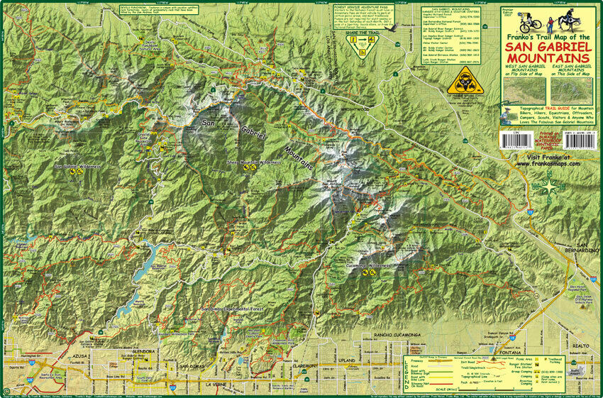
San Gabriel Mountains California Trail Map Poster
$ 7.89
- Description
- Size Guide
Description
This is a shaded relief topographic contour map using hypsometric tints to visualize elevation gains. It shows trails and single tracks, class I, II and III bikeways, national forest roads, dirt roads, picnic areas, ranger stations, trailhead parking and camp sites.Side one covers the Eastern range north of Azusa, San Dimas and Rancho Cucamonga, with the eastern boundary San Bernardino. It includes Devils Punchbowl, Sheep Mountain Wilderness, Cucamonga Wilderness, Mount Baldy, the San Gabriel and Morris Reservoirs, Crystal Lake Recreation area and more. Side two covers the western section north of San Fernando, Burbank, Glendale, Pasadena and Monrovia. It includes Chilao Visitors Center, Sulphur Springs, Deukmajian Wilderness Park, Pacoima Reservoir, and more. There is a realistic illustration of San Gabriel Mountains wildlife.
21" x 14", laminated with edge seal. Ships rolled.
Copyright 2007
